Fishing
Fishing Dufferin County: A Guide's Take
Twenty-six years of guiding these rivers. Chinook and steelhead run an extraordinary distance inland to spawn in Dufferin gravel, brook trout hold in the cold water above them, and the Grand and Credit add bass, walleye and a world-class brown trout tailwater within twenty minutes.
By Graham Bristow — Professional fishing guide, 26 years in the industry
Just show up
Pine, Boyne, Nottawasaga, Noisy, Mad, Grand and Upper Credit systems·20–40 min from Orangeville from Orangeville·Year-round, but seasons and sanctuaries vary by reach·Ontario fishing licence required
Before you go — checked August 9, 2026
- Much of Dufferin's stream frontage is privately owned. Fish being present does not mean access is permitted.
- Seasons, sanctuaries and tackle rules vary reach by reach in the Nottawasaga system. Check the current Ontario Fishing Regulations and Fish ON-Line before you go.
Most people who fish around here think Dufferin is a bass lake and a few small creeks. I’ve guided rivers in this province for twenty-six years and I’ve fished every water in this guide myself — that description misses the most interesting thing about the county by a wide margin.
A note on what follows. Where I’m quoting fisheries science I’ve said so, because the Nottawasaga Valley Conservation Authority has done real work up here and it deserves the credit. Everything else is mine: what I’ve caught, where I’ve caught it, and what I’ve learned the slow way about which water is worth the walk. The two don’t always agree, and where they don’t, I’ve told you that too.
Every photograph on this page is my own, taken on the water it shows — no stock, no borrowed shots. If a picture is here, I was standing there.
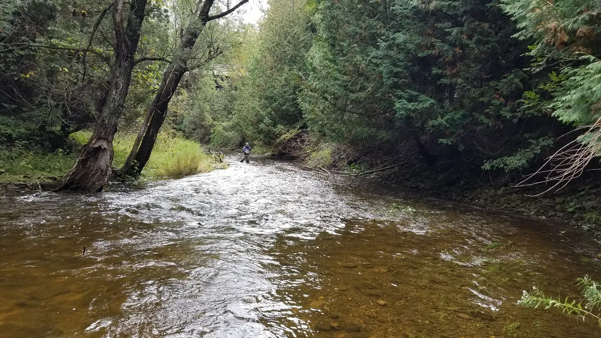
Dufferin sits on the headwaters. The Pine, the Boyne, the Nottawasaga, the Noisy and the Mad all rise in or beside this county, and they drain north to Georgian Bay. Which means the fish come up. Wild Chinook salmon and steelhead push an extraordinary distance inland — past Alliston, past the flats, into water you could throw a stone across — to spawn in gravel that sits in Mulmur and Melancthon and Amaranth.
The Nottawasaga Valley Conservation Authority has put it plainly: the Upper Nottawasaga and the Pine together likely represent the largest source of wild Chinook production in Georgian Bay. Not stocked fish. Wild ones, spawning successfully — NVCA monitoring has found young-of-the-year Chinook and juvenile rainbow trout in these headwaters, which is the difference between fish passing through and fish being made here.
That is a genuinely unusual thing to have at the top of your road.
Start with access, not with fish
I’ll be blunt, because it will save you a wasted morning: in Dufferin, finding fish is not the hard part. Finding legal access is.
Most of the stream frontage in this county is privately owned. A creek crossing a road tells you nothing about whether you may walk it. I’ve watched anglers park at a bridge, drop down the bank and fish two hundred metres of someone’s back field, entirely unaware. That is trespass, it is how access gets closed for everyone, and it is avoidable.
The places where access is established:
- Pine River Provincial Fishing Area — River Road, Mulmur. The clearest public trout water in the county
- Boyne Valley Provincial Park — public land along the Boyne, where fishing is permitted
- Hockley Valley Provincial Nature Reserve — the public way onto the Upper Nottawasaga. Hike in, and earn it
- Island Lake Conservation Area — Orangeville, and the easiest fishing in the county by a distance
- Glen Haffy Conservation Park — just outside the county in Caledon, stocked trout ponds
Everywhere else — the Upper Nottawasaga, Primrose Creek, the Pine outside the fishing area, the Noisy, the Mad, the North and South Branches, Black Bank Creek and the smaller tributaries — access is limited or variable and needs confirming before you set foot on it. Ask. Most landowners around here will give you a straight answer, and a few will give you permission.
The Pine River
If you fish one moving water in Dufferin, make it the Pine.
It rises around Melancthon, runs through Mulmur and eventually joins the Nottawasaga, and it changes character completely along the way. Brook trout hold in the cold headwaters and tributaries. Brown trout are through the system. Below the migration barriers, it takes steelhead and Chinook.
NVCA describes the Pine as supporting one of the largest Chinook runs in the Lake Huron ecosystem. For a river most people in Orangeville have never fished, that is a remarkable sentence.
The barriers matter for working out what you’re likely to meet: NVCA identifies the Boer Dam/Cataract on the South Branch and the Horning’s Mills Dam/Cataract on the North Branch. Above them, resident brook trout. Below, the migratory fish can reach you.
The Pine River Provincial Fishing Area deserves its own mention, because it is the one place in the county I can send someone without a caveat about permission. County tourism material points anglers there for brook and brown trout, and it is honest water — treat it as a stream trout fishery, not a stocked pond. It gets pressure. Fish it early, fish it quietly, and fish small.
For resident trout on the Pine: nymphs, dries and streamers on the fly rod; small spinners, spoons and minnow imitations on light spinning gear. For migratory fish when they’re in: float fishing, beads, roe where legal, flies, small jigs, spinners and spoons.
The Boyne
The Boyne rises around Shelburne, Primrose and Mulmur and runs east toward the Nottawasaga, and it is a legitimate trout river rather than a creek people are being polite about.
Ontario Parks documents brook, brown and rainbow trout along the Boyne inside Boyne Valley Provincial Park — which is where I’d send you first, because the access question is already answered. It’s a non-operating park, so expect a natural setting and no facilities. That suits the fishing: light tackle, short rods, small flies, and stealth. The river is narrow in places and the fish know you’re there before you do.
NVCA also identifies the Boyne as a priority system for migratory rainbow trout and Chinook, and fish passage improvements downstream have opened up considerably more upstream habitat than was reachable a couple of decades ago.
Watch the regulations here especially. There are reach-specific sanctuaries and seasonal closures on parts of the Boyne and wider Nottawasaga system. One section being open tells you nothing about the next one.
Primrose Creek
A genuine mixed-trout stream, and one of the few places in the county where the fish community isn’t a matter of opinion. A 2019 fisheries investigation used electrofishing and minnow trapping in Primrose Creek and directly documented brook, brown and rainbow trout.
Chinook have been caught by anglers in Primrose, and that’s entirely consistent with its connection to the Boyne system — but the 2019 survey didn’t record them, so I’ll call it angler-reported and leave it there.
This is small-stream work: ultralight spinning with small spinners and spoons, or a fly rod with nymphs, dries and small streamers. Access is the usual Dufferin problem — much of that country is private.
The Upper Nottawasaga and its branches
The Nottawasaga starts in the Dufferin and Amaranth headwater landscape, and it is not the trickle the name suggests at that end.
This is the other half of NVCA’s wild Chinook statement, and the monitoring behind it found juvenile fish, not just adults. Depending on the reach and the season you might meet anything from a small resident trout to an adult steelhead or a Chinook that has swum a very long way to get to you.
The North Branch and its tributaries are important brook trout habitat and a restoration priority, with Scott’s Falls acting as the barrier separating migratory water below from resident trout above. The South Branch is part of the same coldwater network — Singing Waters Cataract is the barrier there — but I’m not going to hand you a reach-by-reach species list for it, because the public data isn’t detailed enough to justify one. It’s trout water. That’s as far as I’ll go.
Where you can actually get on it
The public access to the Upper Nottawasaga is Hockley Valley Provincial Nature Reserve — 378 hectares of mature forest dropping to the river where it cuts its gorge across the escarpment. Free, hiking only, about fifteen minutes from town.
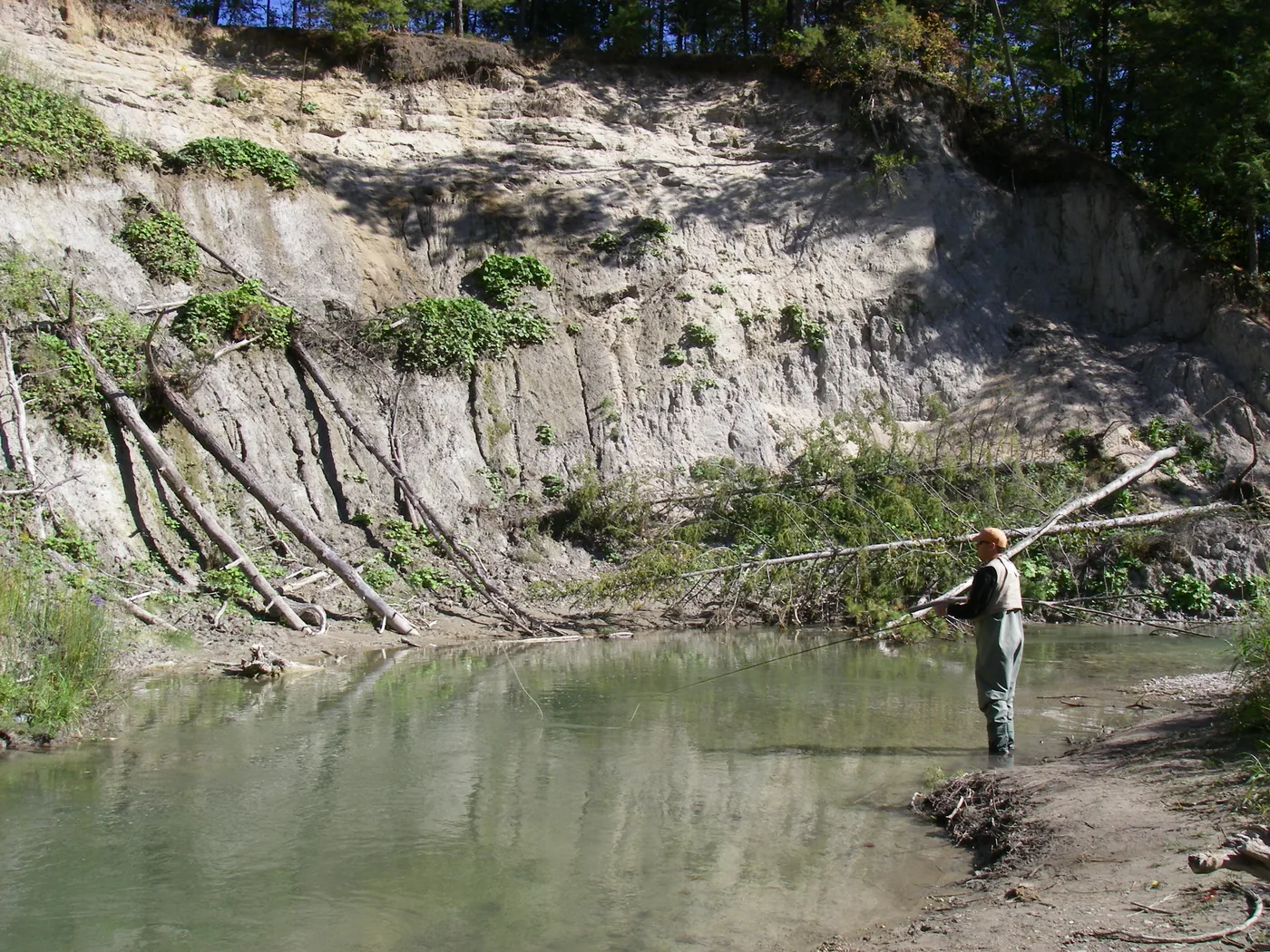
I’ve fished that section many times, so let me set expectations properly: it is difficult fishing. The river in there is small and there is wood in it everywhere — deadfall, sweepers, jams. You will lose flies. You will spend as much time working out how to get a drift into a slot as you do fishing it. Long casts are useless; short, accurate ones with the rod tip doing the work are what catch fish.
You also have to walk in, and the valley sides are steep. That filters out most people, which is exactly why it’s worth doing.
What’s in there: steelhead, brown trout and brook trout. Hiking in and finding a pocket that hasn’t been touched all season is genuinely rewarding — and on the right day it fishes better than water ten times its size.
The Noisy and the Mad
Both run through the northern Dufferin and Mulmur country, and both are brook trout waters first and foremost. The Noisy and its tributaries are identified by NVCA as important brook trout habitat and a restoration priority, with Lavender Falls as the significant barrier. The Mad River headwaters hold brook trout, with rainbow trout documented as well.
Think small on both: dry flies, nymphs and small streamers, or ultralight spinning with small spinners and spoons.
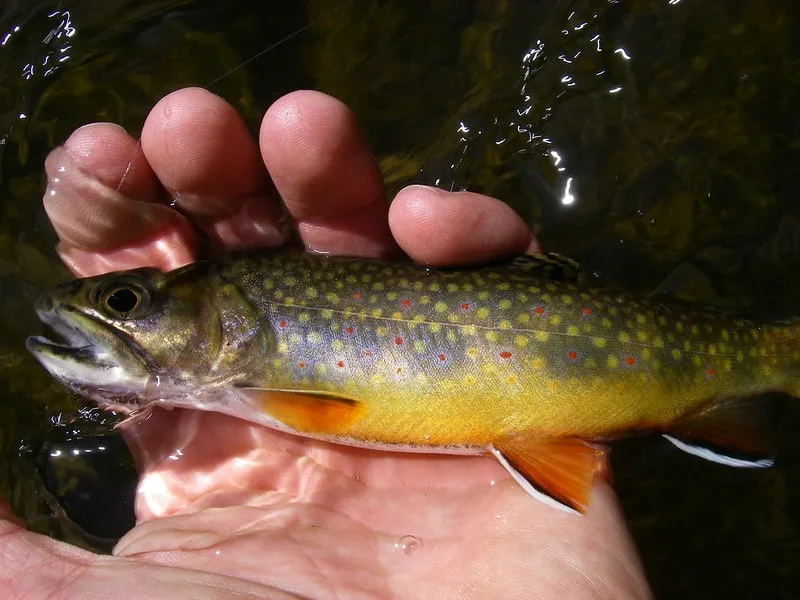
On steelhead up here — what I’ve actually caught
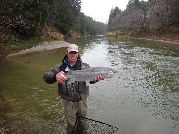
The agency documents are cautious about migratory fish this far up, and you’ll read that the evidence isn’t strong. I’ll give you mine instead: I have caught steelhead in both the upper Mad and the Noisy.
Not many, and not reliably. But they are there, and anyone telling you the upper reaches are strictly a resident brook trout fishery is working from paperwork rather than from time in the water.
There are also reports of the occasional salmon taken up here — specifically in autumns when heavy rain puts the rivers up. That is the pattern worth understanding: high water is what lets fish over the obstacles that stop them in a normal year. A dry fall and they don’t get near this far. A wet one and the whole picture changes.
So don’t plan a trip around it. But if you’re up there after a big autumn rain, fish it like something larger might be holding, because occasionally something is.
One genuine caveat that still stands: NVCA has noted uncertainty over whether the Mad’s rainbow population is migratory or resident, so don’t assume every Mad River rainbow is a steelhead. Some of those fish live there. Brown trout are part of the restoration picture in the Mad coldwater complex too, though that doesn’t mean they’re evenly spread through every Dufferin reach.
Island Lake, and the other kind of fishing
Everything above is coldwater and most of it needs a plan. Island Lake is the opposite: five minutes from Broadway, ten accessible piers, pay at the gate, walk on.
Largemouth bass, northern pike, black crappie, yellow perch and panfish, in shallow weedy water that suits all of them. It’s the best family fishing in the county, the best shore fishing, and the only local water where you can put a boat or a kayak on and cover ground. I’ve written that one up separately because it deserves its own page.
For families specifically, Glen Haffy Conservation Park in Caledon is worth knowing about — stocked trout ponds, which is a completely different proposition to wild fish in the Pine and exactly right for a first rod.
The other watershed: the Grand
Everything above drains north to Georgian Bay. But Dufferin sits on a divide, and the western side of the county drains somewhere else entirely — into the Grand, and eventually Lake Erie.
That gives you a completely different set of fish within twenty minutes of the same driveway.
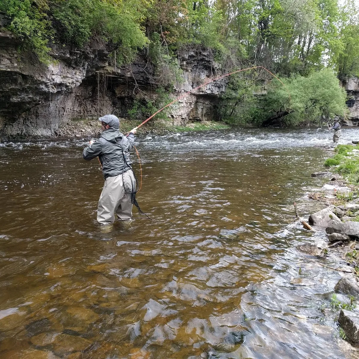
The Grand above Belwood — and this part is in Dufferin
The Grand rises northeast of Dundalk and runs down through Melancthon, Amaranth, East Garafraxa and Grand Valley before it reaches Belwood Lake. This is Dufferin County water, and almost nobody fishes it.
Forget trout up here. GRCA identifies this stretch as holding smallmouth bass, northern pike, yellow perch and carp — a warmwater river, not a coldwater one.
The smallmouth are the reason to go. I fish the deeper pools, the bridge holes, rocky runs, current seams, outside bends, and the slots below riffles — anywhere the current does the work of concentrating fish. Tubes, Ned rigs, small crawfish plastics, small cranks, inline spinners. On the fly rod, woolly buggers and crayfish patterns. Summer into early fall is the window.
Pike show up in the slower water — deeper bends, backwaters, slack water beside cover, and increasingly as you get closer to the reservoir. Spinnerbaits, spoons, jerkbaits, swimbaits. Perch hold in the same softer water, and there are carp where it broadens out, which more people should take seriously than do.
On access, be realistic. There are plenty of municipal bridge crossings between Dundalk and Belwood, and much of the bank between them is private farmland. This is an exploration fishery — you find a legal spot, you learn it, and you go back. It is not a river with continuous public frontage.
Belwood Lake
The reservoir behind Shand Dam, and the most versatile multi-species water in this whole guide. Northern pike, walleye, smallmouth bass, yellow perch and black crappie.
It is a reservoir, which means it has an old river channel running through it, and understanding where that channel sits is worth more than covering water. Fish move between shallow and deep along it.
- Pike — spring in the shallow bays, warming flats, flooded vegetation and inflows; summer out on the deeper weed edges, points and channel breaks
- Walleye — the real one. Early morning, evening, cloudy days. Channel edges, points, drop-offs, current coming into the reservoir, and deeper water toward the dam. Jig and plastic, jig and minnow where legal, trolled cranks, bottom-bouncers with a worm harness
- Smallmouth — rocky shoreline, points, riprap, harder bottom, isolated rock and wood. Tubes, Ned rigs, drop-shot, jerkbaits, topwater in low light
- Crappie — spring, in the warmer protected bays around wood and emerging weed. Small jigs and plastics
- Perch — weed edges, flats, shoreline breaks
There is a boat launch at Belwood Lake Conservation Area and powerboats are allowed, but a canoe or kayak is genuinely better for working shoreline structure quietly. It also fishes through the ice — GRCA lists pike, perch and walleye — and you check their access status before you drive out, every time.
The Grand below Shand Dam — the best trout water near Orangeville
This is the one. If you want a serious trout river within reach of Orangeville, it is the tailwater below Shand Dam, and it is not close.
Shand releases cold water out of the bottom of Belwood, which turns the Grand below it from the warmwater river above into a coldwater brown trout fishery that runs well downstream toward West Montrose. It has an international reputation and it has earned it. These are much bigger fish than the headwater streams up in Dufferin will ever produce.
The river down there has everything you want to read: riffles, long runs, pools, deep slots, weed beds, undercut banks, seams and limestone structure.
- Nymphing is the dependable method — riffle edges, seams, drop-offs, weed edges, deeper runs. Caddis, mayfly and midge patterns by season
- Dry fly — it is a hatch river, and that is what people travel for. Watch the slicks, pool tails, slower edges and flats beside faster water
- Streamers for the big browns. Cloud, early, late, or slightly stained water. Undercut banks, deep slots, structure, the transitions between fast and slow
Two warnings, and I mean both of them.
First, special regulations apply to substantial portions of this tailwater — artificial lures only in places, barbless hooks, and trout harvest restrictions, and they are not uniform reach to reach. If you normally fish worms, roe, beads or live minnows, do not assume you can here. Check the exact FMZ 16 exception for the specific stretch you intend to fish.
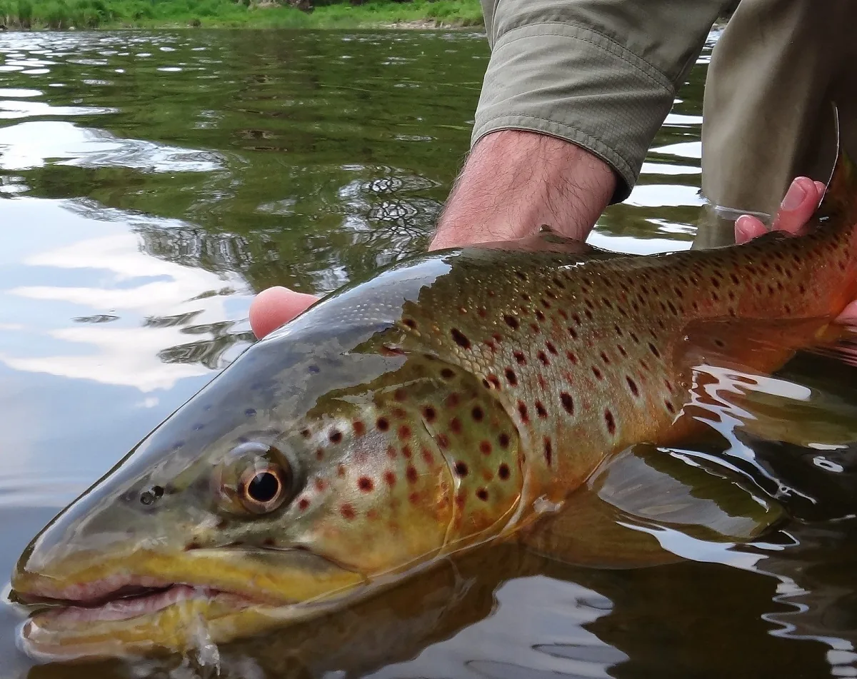
Second, the flow is controlled by the dam. A crossing that is comfortable at one release becomes impossible after another. I have seen the river come up on people who were not paying attention. Know where your exit is before you wade in.
The Upper Credit
Here is a thing most people in Orangeville have never thought about: part of the Credit River starts in Island Lake. The same reservoir you catch pike and largemouth out of is the head of one of southern Ontario’s better trout rivers.
Go ten to twenty minutes south and you are into genuinely good brook trout and brown trout water.
Credit Valley Conservation identifies the upper watershed as a critical coldwater community. Brook trout are the signature fish of the uppermost sections — and CVC notes they survive as a fragmented set of cold headwater populations, which is why the little groundwater-fed tributaries matter so much and why I am careful about where I take people. Brown trout become more important as you move downstream.
It is small- to medium-stream fishing, not big water. Small nymphs, caddis and mayfly imitations, terrestrials once summer is on, small streamers, dries into a hatch. On spinning gear, 1/16 to 1/8 ounce spinners, tiny spoons, small minnow plugs, ultralight plastics.
Fish it like the water is clear and the trout can see you, because both are true. Stealth matters more here than tackle does.
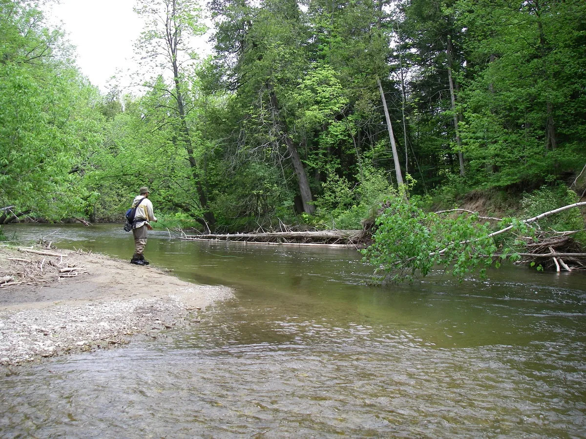
It is worth understanding what the Credit is doing further down, because it explains the fish you meet up here. Thirty-odd kilometres south, the lower river takes migratory salmon and steelhead out of Lake Ontario every autumn — I have spent a lot of falls down there, and the coho in the photo above came off it. None of those fish reach the upper river. What you are fishing for around Alton and Belfountain are resident trout that live their whole lives in cold groundwater. One river, two entirely separate fisheries, and the top end is the fragile one.
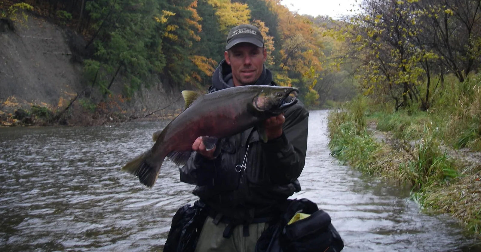
Where you can go:
- Upper Credit Conservation Area, near Alton — CVC promotes it specifically for brook trout
- Belfountain Conservation Area — access to the West Credit, promoted for fly fishing. Brook trout above the dam, browns below it, and anglers must stay at least 50 metres downstream of the dam
I have guided clients at Belfountain and it fishes well. One of mine took rainbows and brook trout in numbers just above the falls — that stretch is better than its size suggests, and most people walk past it to look at the bridge.
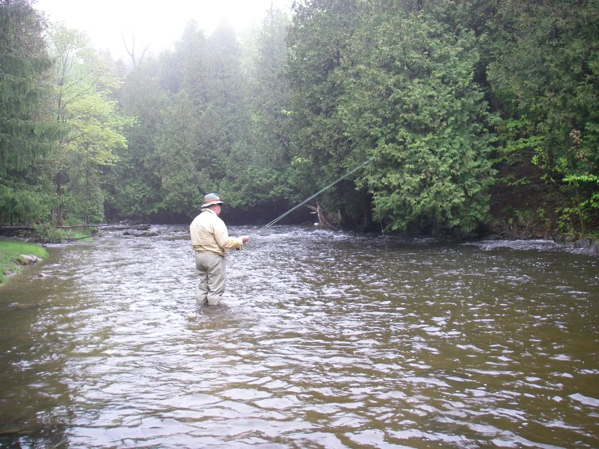
Outside those properties, the usual caution applies and CVC says it plainly: the water may be public but the bed and banks can be private. A road crossing is not permission.
Check the regulations before you go. Special rules apply to parts of the Credit in Caledon, including between Old Baseline Road and Highway 9, and some conservation areas add their own restrictions such as live-bait bans. The standard FMZ 16 trout season generally opens the fourth Saturday in April and closes September 30 — subject to exceptions, and the exceptions are the point.
Luther Marsh — and I’ll be straight with you
This is the one water in this guide I have not fished. Everything else here I have fished and guided clients on. Luther Marsh I have not, so what follows is GRCA’s information rather than mine, and I have flagged it rather than dress it up.
Luther Marsh Wildlife Management Area is enormous — around 5,780 hectares, centred on the roughly 1,400-hectare Luther Lake, part of it in Dufferin and the rest in Wellington.
It looks, from above and from the shore, like the best pike and bass habitat for a hundred kilometres. Shallow, weedy, stumps, flooded cover, endless bays.
It isn’t, and you will read otherwise online.
GRCA — who manage the property — currently describe Luther Lake as a relatively poor sportfish fishery, and state that what is in there is yellow perch, brown bullhead and minnows. Not pike. Not bass. You will find anecdotal claims about both, and I am not going to repeat them in a guide with my name on it when the managing authority says otherwise.
The reason is winter. The lake is shallow and heavily vegetated, and that dense vegetation drives dissolved oxygen down under the ice. Habitat that looks perfect in July does not carry a sportfish population through February.
If you are there anyway — and it is a genuinely special piece of country — perch are worth a go with small jigs, small plastics, worms or small minnows where legal, around the openings in the weed, the channel-like areas and the edges where vegetation meets open water. Bullhead near the bottom on worms toward evening.
Access is unusually specific, so read this before you plan anything:
- Self-register through GRCA’s ePass. Open dawn to dusk
- Canoes, kayaks and rowboats from 31 July. Before 1 September, launching is from the two put-ins on the interior road
- Motorboats after 1 September, 25 hp maximum, four marked launches. Anyone using a watercraft must complete GRCA’s boat-access registration
- The lake is extremely shallow, weedy and full of submerged stumps — go slow, and expect to hit things
- Stay out of the sanctuary and heronry areas on the north side
- It is heavily hunted. For 2026, gun hunting runs Mondays, Wednesdays, Fridays and Saturdays from 1 September to 28 February. GRCA advises non-hunting visitors to come Tuesdays, Thursdays or Sundays — and there are exceptions for opening days and controlled hunts
Would I drive out there specifically to fish? No. Would I take a rod if I were going anyway to paddle it or look at birds? Absolutely — it is one of the largest natural areas anywhere near this county and worth seeing on its own terms.
What I’m not going to tell you
There are numerous small coldwater tributaries through Mulmur, Melancthon, Amaranth and Mono. Some hold brook trout. A few hold very good ones.
I’m not publishing where.
Some of those streams are narrow enough that a handful of anglers would change them. Some hold sensitive populations. Some have historical records that don’t reflect what’s living there now. And a fair number cross entirely private ground, so naming them would just generate trespass.
If you want to find them, the honest route is the one I took: time on the water, a map, and asking landowners politely. That’s not me being precious — it’s how those fish are still there.
By season
Spring — trout after the season opens, and migratory rainbows where seasons and access permit. Island Lake produces pike, crappie and perch subject to their own seasons.
Summer — the cold groundwater-fed streams keep fishing, but think hard about warm-water stress on trout in a hot spell. If the water’s warm, leave them alone. Island Lake becomes the bass fishery.
Fall — the interesting one. Chinook move into the Nottawasaga system and reach a long way up the accessible parts of the Pine, Boyne and Upper Nottawasaga, with migratory rainbows behind them. Fall is also when sanctuaries and reach-specific closures matter most. Check before every trip, not once a season.
Winter — ice fishing at Island Lake when Credit Valley Conservation says conditions allow, and Belwood Lake for pike, perch and walleye when GRCA says the same. Check the access status before you drive out to either, every time.
One more thing about seasons. The standard FMZ 16 trout framework opens on the fourth Saturday in April and closes 30 September — but that is the default, and this article is full of waters that carry their own exceptions. The Credit in Caledon has them. Substantial parts of the Grand tailwater have them. Reaches of the Boyne and Nottawasaga have sanctuaries. Look up the water you are going to, not the zone it sits in.
Before you go
A valid Ontario fishing licence — Outdoors Card plus sport or conservation licence — covers you everywhere in this guide. Dufferin is in Fisheries Management Zone 16.
But the zone rules are the floor, not the whole story. Individual reaches in the Nottawasaga system carry their own sanctuaries, seasons and tackle restrictions, and they are not consistent from one stretch to the next. Check the current Ontario Fishing Regulations Summary and Fish ON-Line before you fish — and check the specific water, not just the zone.
Respect the private property, the posted signs, the park and conservation authority rules, and the sanctuaries. Dufferin’s fishing is good because most of it has been left alone. That is worth keeping.
Frequently asked questions
Are there salmon in Dufferin County?
Yes — wild Chinook salmon run into the Pine River, Upper Nottawasaga and Boyne River in the fall. The Nottawasaga Valley Conservation Authority has stated the Upper Nottawasaga and Pine together likely represent the largest source of wild Chinook production in Georgian Bay. Migration barriers determine how far up each branch fish can reach, and fall is exactly when sanctuary and seasonal closures matter most.
Where can you fish for brook trout in Dufferin County?
Dufferin is genuinely good brook trout country. The documented systems are the Pine River headwaters and tributaries, the Boyne headwaters, Primrose Creek, the North Branch Nottawasaga and its tributaries, the Noisy River and the Mad River headwaters. The Pine River Provincial Fishing Area is the clearest public-access option; most of the rest crosses private land.
What is the best public fishing spot in Dufferin County?
For stream trout, the Pine River Provincial Fishing Area on River Road in Mulmur — it is the county's most clearly established public trout water. For warmwater fishing and for anyone who wants to turn up without a plan, Island Lake Conservation Area in Orangeville. Boyne Valley Provincial Park also offers public access along the Boyne.
Do you need a licence to fish in Dufferin County?
Yes. A valid Ontario Outdoors Card plus a sport or conservation licence covers you anywhere in the province, including every water in this guide. Dufferin sits in Fisheries Management Zone 16, and individual reaches carry their own seasons, sanctuaries and tackle restrictions on top of the zone rules.
Where can you fish the Upper Nottawasaga River?
The public access is Hockley Valley Provincial Nature Reserve — 378 hectares of forest dropping to the river where it cuts its gorge across the escarpment, free and hiking only, about 15 minutes from Orangeville. It is difficult small-stream fishing with a great deal of wood in the water, and you have to walk in down steep valley sides. It holds steelhead, brown trout and brook trout, and the effort is why it stays worth fishing.
Are there steelhead in the Mad River or Noisy River?
Yes, though not in numbers you would plan a trip around. I have caught steelhead in both the upper Mad and the Noisy. Agency documents are cautious about migratory fish that far upstream, and they are right that these are brook trout waters first. There are also reports of the occasional salmon in autumns when heavy rain raises the rivers enough for fish to pass obstacles that stop them in a normal year.
Can you fish the Boyne River?
Yes, and Ontario Parks documents brook, brown and rainbow trout along the Boyne inside Boyne Valley Provincial Park, which is the sensible place to start because access is permitted. Much of the rest of the Boyne runs through private property, and parts of the Boyne and wider Nottawasaga system carry reach-specific sanctuaries and seasonal closures.
Details checked August 9, 2026. Fees, hours and closures change — phone ahead for anything that would ruin the trip if it were wrong.
Something out of date? Tell us →